Highway 101 in Oregon runs 363 miles along the entire coast, from the Columbia River at Astoria to the California line just south of Brookings. You could drive it in a day, but you’ll want to take your time. The journey offers some of the most spectacular scenery in the Pacific Northwest: dramatic sea stacks, temperate rainforests, iconic lighthouses, and charming seaside towns.
This guide covers the southern end: roughly 110 miles from Coos Bay to Brookings. It’s the least crowded part of the coast; the towns are smaller and farther apart, and we think the last stretch before California saved the best scenery for last.
We’ve spent years offering guidance to guests of our Bandon Hotel. So think of this as the version we’d hand a friend.
Highway 101 Oregon at a Glance:
Known as: Oregon Coast Highway No. 9 (US 101), The Pacific Coast Highway, or simply “the 101”
Length in Oregon: 363 miles, Astoria to the California border
Scenic designation: Pacific Coast Scenic Byway
Distance in this Southern Coast Guide: Coos Bay to Brookings, about 110 miles
Westernmost point nearby: Cape Blanco, a short detour north of Port Orford
Road conditions: ODOT’s TripCheck.com or dial 511 in Oregon
The Oregon Coast Highway Turns 100
Highway 101 became a federal route on November 11, 1926, so this fall marks its centennial. The Oregon Historical Society celebrated with 101 at 100, an exhibition in Portland that traced the road from Indigenous travel routes to the coastal lifeline it is now.
Before bridges went up in the 1930s, crossing the bigger bays and river mouths meant waiting on a ferry. Leading civil engineer Conde McCullough completed many structures in Oregon, including over 30 arched bridges. The Highway 101 span at Coos Bay was his favorite design. The impressive bridge was the longest in the state when completed in 1936. After McCullough’s death, the bridge was renamed the McCullough Memorial Bridge
How Long Does It Take to Drive the Oregon Coast?
Driving all 363 miles of Highway 101 in Oregon takes at least 8 to 9 hours with no stops. No one we know would drive it that way. Most people plan on four to five days for the whole coast, or one full day for the southern stretch we recommend.
We break down the 108 miles from Coos Bay to Brookings into four segments of 24-28 miles, or about 30 minutes of driving. Total driving time without stopping is about two hours, but we recommend stops for each segment.
- Coos Bay to Bandon– Cape Arago Highway and Bullards Beach
- Bandon to Port Orford– stop at Cape Blanco
- Port Orford to Gold Beach– Humbug Mountain and Prehistoric Gardens
- Gold Beach to Brookings– Cape Sebastian and Samuel H. Boardman Corridor
We should be honest: Highway 101 does not follow the ocean the whole way. North of Bandon and between Bandon and Port Orford, it runs inland through farmland, forest, and cranberry bogs. The big, wall-to-wall ocean views start south of Port Orford and build all the way to the California line.
Best Stops on Highway 101 Oregon: Coos Bay to Brookings
We’ve listed these heading south, because southbound puts you in the lane closest to the ocean. That makes pulling into viewpoints a lot easier. Coming up from California? Just read it bottom to top.
Coos Bay and the Cape Arago Highway
Coos Bay and North Bend together form the largest urban area on the Oregon Coast, which makes them a practical place to fuel up. Here, take the spur onto Cape Arago Highway. You will head southwest through the fishing village of Charleston past three state parks: Sunset Bay, Shore Acres, and Cape Arago.
The beautiful sandy beaches at Sunset Bay State Park are protected by tall sea cliffs. Shore Acres has formal clifftop gardens with an enclosed shelter built for storm watching. Cape Arago sits about 14 miles from town, with sea lion viewpoints and tide pools below. From there, backtrack to the 101 and continue south.
Bandon: Leave the Highway on Purpose
Just north of Bandon, the 101 crosses the Coquille River beside Bullards Beach State Park and the Coquille River Lighthouse. Both are worth at least an hour. Through town, though, the highway stays a few blocks inland. Turn off, Bandon’s best views sit along the bluffs.
Wander through Old Town, grab fish and chips, and stop at Face Rock Creamery. Then take Beach Loop Drive south past Coquille Point and Face Rock State Scenic Viewpoint, where a lineup of sea stacks rises straight out of the surf. The loop rejoins the 101 south of town. Our inn sits right across from Face Rock.
Cape Blanco
About 4 miles north of Port Orford, Cape Blanco Road runs roughly 5 miles west through open pasture to the westernmost point in Oregon. The lighthouse here was built in 1870 and is the oldest standing lighthouse on the Oregon coast. Tours run seasonally, so check with Oregon State Parks before you make the detour. Bring a jacket. The wind here is strong and can chill you to the bone, even in the summer.
Port Orford
Port Orford is small, salty, and is the westernmost incorporated city in the continental U.S. The active working harbor features the only “Dolly Dock” on the West Coast, where fishing boats are lifted by crane directly in and out of the water. Walk out to Battle Rock in the middle of town, or drive up to Port Orford Heads State Park for a big view south toward Humbug Mountain.
Humbug Mountain and Prehistoric Gardens
South of town, the 101 curves around the base of Humbug Mountain, the peak you could see from Port Orford. Humbug Mountain State Park has a trail to the summit if you are up for a strenuous hike. A little farther south, Prehistoric Gardens has been a family-owned roadside stop since 1955, with life-size dinosaurs tucked into a coastal rainforest. It’s kitschy, dog-friendly, and a must-stop if you are traveling with kids.
Gold Beach and the Rogue River
You’ll roll into Gold Beach across the Rogue River on the Isaac Lee Patterson Bridge, another McCullough design. Gold Beach is the launch point for jet boat trips up the Rogue, the classic half-day adventure on this part of the coast. About 7 miles south, Cape Sebastian has a short walk out to a high headland viewpoint that looks down the coast toward California.
Samuel H. Boardman State Scenic Corridor
These 12 miles are the reason people drive this far south. The corridor is one pullout after another, with stops like Arch Rock, Natural Bridges, Secret Beach and Indian Sands. Most viewpoints sit just steps from the car, and a stretch of the Oregon Coast Trail links them for anyone who wants a longer walk.
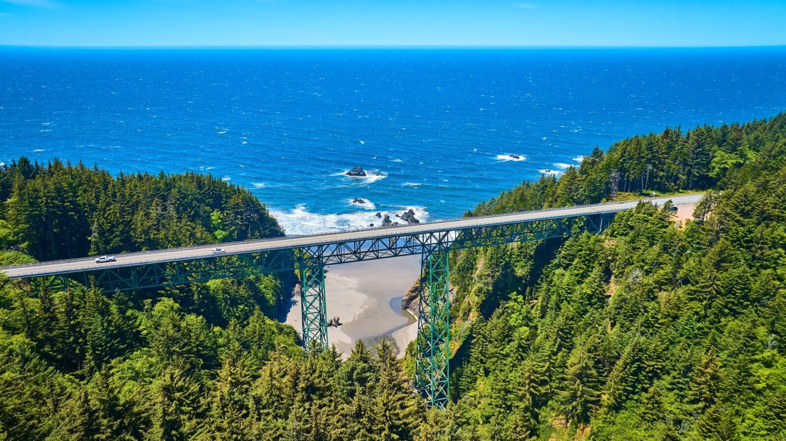
Partway through, you’ll cross the Thomas Creek Bridge, Oregon’s tallest bridge at 345 feet. It sits about 8 miles north of Brookings, and most drivers cross it without ever realizing how high they are. Park at a pullout on either end and walk back for the view. Some trails run close to cliff edges, so stay on the path and behind any barriers. Give the corridor at least half a day if you want to walk the short trails.
Brookings
Brookings is the last full-service town before California and sits in what locals call Oregon’s banana belt, often a few degrees warmer than the rest of the coast. Harris Beach State Park, just north of town, is a lovely place to end the day with sea stacks and a sunset.
Driving Tips for the Southern Stretch of Highway 101
The southern 101 is an easy drive; it’s important to be prepared. Here’s what we tell guests before they head out:
- Check TripCheck before you leave. The highway is mostly two lanes, and landslides or construction can close sections without much warning. On parts of the south coast, the detour means driving inland over the Coast Range, which can add hours.
- Fill up the gas tank in the bigger towns. Coos Bay, Bandon, Gold Beach and Brookings all have full services.
- Cell coverage can be spotty in the Boardman corridor and around Humbug Mountain, so download your maps ahead of time.
- Use the turnouts. If a line of cars builds up behind you while you’re admiring the view, pull over and let them by.
- Plan around fog and daylight. Summer mornings often start socked in, with views clearing by early afternoon. In winter, daylight runs short, so aim to reach your overnight stop before dark.
- Watch for wildlife at dawn and dusk. Deer and Roosevelt elk wander onto the road on the south coast, especially near river valleys.
- Consider the off-season. From late fall through spring, you’ll share the road with far fewer RVs. You also get storm watching and the winter gray whale migration.
Where to Break Up the Drive: Southern Oregon Coast Hotels
If you’re driving the full southern stretch, Bandon is the natural place to spend the night. It has more restaurants, shops, and lodging than anywhere between Coos Bay and Brookings. It also puts both ends of this guide within reach. Most of our guests stay at least two nights. This lets them spend one day heading north to the Cape Arago parks and another making the longer run south to the Boardman corridor and back.
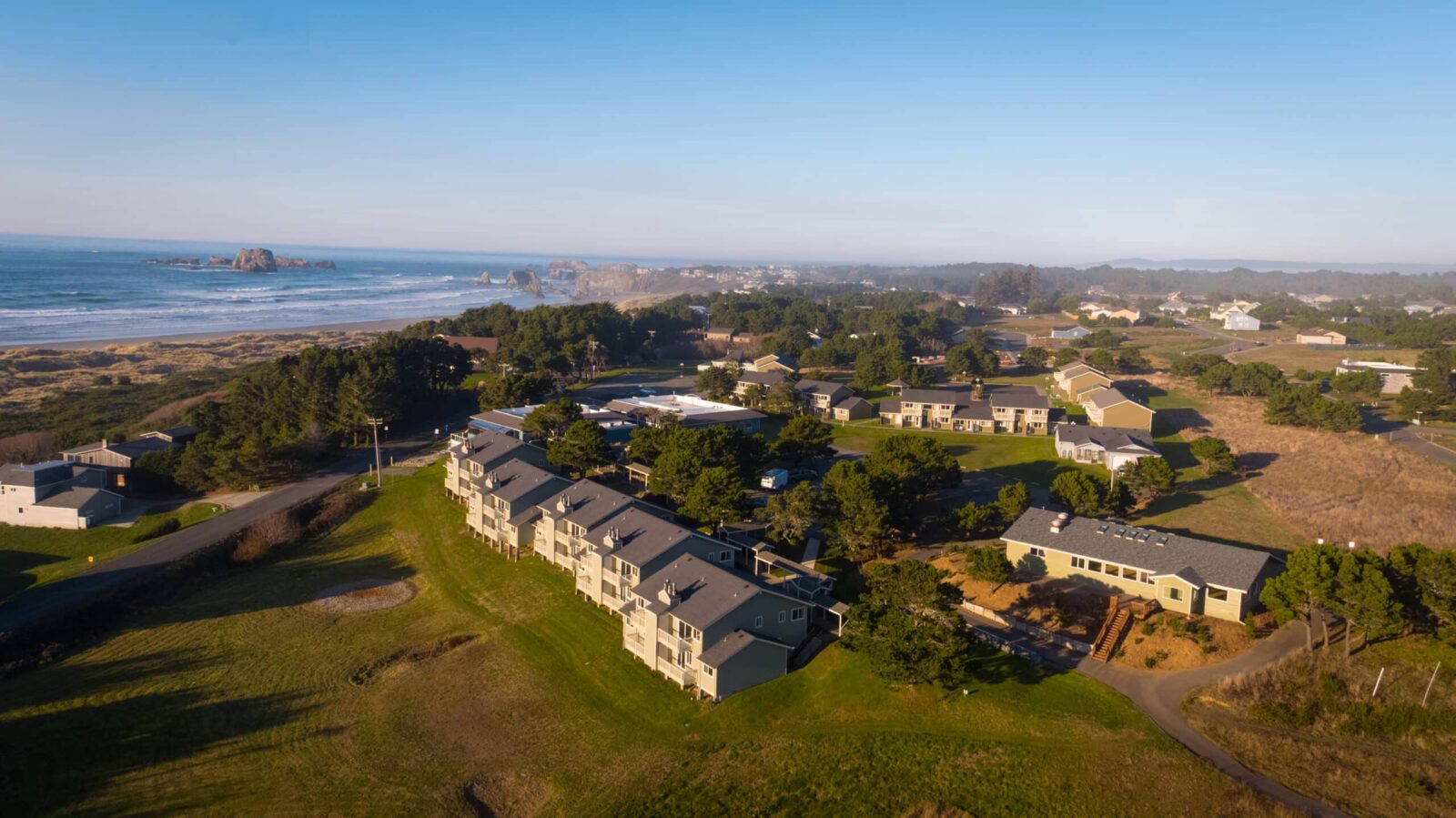
The Inn at Face Rock sits on Beach Loop Drive, directly across from Face Rock State Scenic Viewpoint, with a private path down to the beach. After a day in the car, you and the kids will love the indoor pool and hot tub. Rooms run from standard kings and queens to suites with fireplaces and kitchenettes, plus a Beach House for families and groups. Some rooms are pet-friendly, breakfast is included, and the front desk is staffed around the clock.
View our rooms, check our current specials, or book your stay.
Starting in Portland? Our Portland-to-Bandon road trip itinerary covers the northern half of the coast. For more to see and do around town, browse our Southern Oregon Coast Guide.
Highway 101 Oregon FAQs
Is it worth driving Highway 101 in Oregon?
Yes, especially on the southern end. The roughly 60 miles from Port Orford to the California border hold some of the most dramatic coastline on the entire route. Just know that the highway runs inland in places, so the best views come in stretches rather than all at once.
Is Highway 101 in Oregon currently closed?
Conditions change daily, so check ODOT’s TripCheck.com or dial 511 before you set out. Landslides, storms, and construction occasionally close sections, and detours on the south coast can be long.
What is the most scenic part of Highway 101 in Oregon?
On the south coast, it’s the Samuel H. Boardman State Scenic Corridor, the 12 miles just north of Brookings. It packs sea arches, hidden beaches, and Oregon’s tallest bridge into a very short drive.
What is the prettiest town on the Oregon coast?
That depends on what you’re after, but on the south coast we’re biased toward Bandon. It offers a walkable Old Town harbor with some of the most photographed sea stacks in the state. Port Orford is the pick if you want something quieter and more rugged.
How long does it take to drive the Oregon coast?
The full 363 miles of Highway 101 takes at least 8 to 9 hours of pure driving. Most people spread it over four to five days. The southern stretch from Coos Bay to Brookings runs about 108 miles, or roughly 2.5 hours without stops.
Is Highway 101 the Pacific Coast Highway in Oregon?
In everyday use, yes. When people say “Pacific Coast Highway” in Oregon, they mean the 101. Officially, it’s the Oregon Coast Highway, and it’s part of the Pacific Coast Scenic Byway.
Can you drive Highway 101 in the winter?
Yes, the highway stays open year-round. Winter brings storms, shorter days, and the occasional closure, so build in extra time. You’ll get empty beaches, storm watching, and migrating gray whales.