If you’re staying in the Columbia River Gorge and only have time for one drive, make it the Historic Columbia River Highway. The first scenic highway ever built in the United States, it offers the same waterfalls, cliffside views, and basalt tunnels that made it famous back in 1913. From Carson Ridge Luxury Cabins, you’re about an hour from the western end of the route, which makes it an easy full-day outing or even a half-day loop if you’re picking your stops carefully.
This guide covers the full route, the landmarks worth stopping for, what’s currently open (road construction here changes more often than you’d think), and how to fit the drive around a stay at our cabins. Book your stay today!
A Quick History of America’s First Scenic Highway
Built between 1913 and 1922, the Historic Columbia River Highway was engineered by Samuel Lancaster with a simple goal: let people experience the Gorge’s scenery from the comfort of a car, without blasting through the landscape to do it. The road curves with the contours of the cliffs instead of cutting straight lines.
When Interstate 84 was built through the Gorge in the 1950s, long stretches of the original highway were bypassed or destroyed. What survived earned National Historic Landmark status, and over the past few decades, Oregon has been steadily restoring the missing pieces as a mix of drivable road and car-free trail. The 73-mile route between Troutdale and The Dalles isn’t fully reconnected yet, but the most scenic section is complete and open to cars.
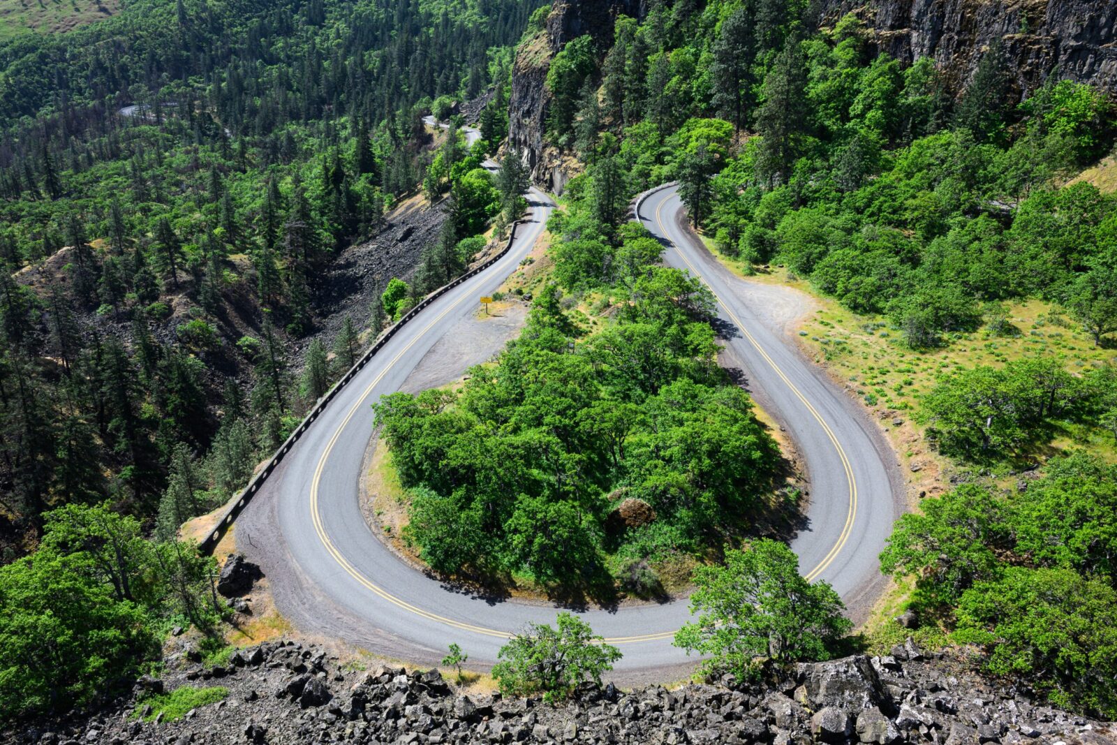
Historic Columbia River Highway Map and Route Overview
The scenic drive runs from Troutdale, just east of Portland, to Ainsworth State Park, a stretch of roughly 20 miles known as the Waterfall Corridor. This is where you’ll find Vista House, Latourell Falls, Bridal Veil Falls, Wahkeena Falls, Multnomah Falls, and Horsetail Falls, all within a short drive of each other.
Past Ainsworth, the highway continues eastward toward Cascade Locks, Hood River, Mosier, and eventually The Dalles, though this section alternates between drivable road and pedestrian-and-bike-only trail segments. Unless you’re planning a full-day trip or a bike tour, most visitors treat the Troutdale-to-Ainsworth stretch as the main event and use I-84 to connect to anything farther east.
Which Sections You Can Drive vs. Trail-Only Segments
This is the part of the highway that changes most often, so treat any specific closure info you read (including this) as a starting point, not gospel. As of this writing, the two historic viaducts flanking Multnomah Falls, which had been closed for restoration since 2024, have both reopened to vehicles and bikes. The section between Portland Women’s Forum and Vista House has a history of temporary closures.
Before your trip, check Oregon’s TripCheck site or the Vista House website for conditions for the same week. Corbett Hill Road (Exit 22) and Bridal Veil (Exit 28) off I-84 both connect back to the highway if you hit a closed section partway through.
If you’re up for adding a hike to the day, Larch Mountain Road splits off the highway near this same stretch and climbs to one of the best panoramic viewpoints in the Gorge. See our full Larch Mountain hiking guide if you want to include that.
Do You Need a Permit to Drive the Historic Columbia River Highway?
No, not anymore. Oregon ran a pilot vehicle permit program for the Waterfall Corridor in 2022 to reduce congestion, but it wasn’t renewed in subsequent years. As of now, you can drive the entire highway, including the Waterfall Corridor between Vista House and Multnomah Falls, without a timed-entry permit.
There’s one exception worth knowing about: if you plan to park at Multnomah Falls using the larger lot off I-84 (Exit 31), that lot requires a separate Multnomah Falls Timed Use Permit during peak summer months, typically late May through early September, between 9 a.m. and 6 p.m. The smaller parking area directly on the Historic Highway, across from the falls, doesn’t require an advance permit but does charge an on-site parking fee. If you’re driving the historic route, this distinction matters, so plan your stop at Multnomah Falls with it in mind.
Crown Point and Vista House
About 11 miles into the drive from Troutdale, the road climbs to Crown Point, a basalt outcrop standing more than 700 feet above the river. Vista House sits right at the top: an octagonal stone building finished in 1918. Built partly as a rest stop for early motorists and partly as a memorial to Oregon’s pioneers, it looks almost too ornate for a highway pit stop, with a domed ceiling, marble floors, and a small museum and gift shop inside.
Vista House itself typically keeps shorter hours than the viewpoint around it, generally open Friday through Monday, so check current hours if you want to see the interior. It can also close on short notice during high winds or extreme summer heat because the century-old structure lacks air conditioning. The viewpoint and parking area offer a longer daily schedule, and a state day-use parking pass applies here as it does at most Oregon state parks along the route.
Getting to Crown Point Viewpoint
Even if Vista House is closed, the point of stopping here is the view, and that’s available any time you can find parking. Looking toward the Columbia River is one of the most photographed panoramas in the Gorge, with the highway itself winding below you along the cliffside. Early morning or just before sunset is your best bet for both lighting and parking, since this is one of the most visited stops on the entire drive.
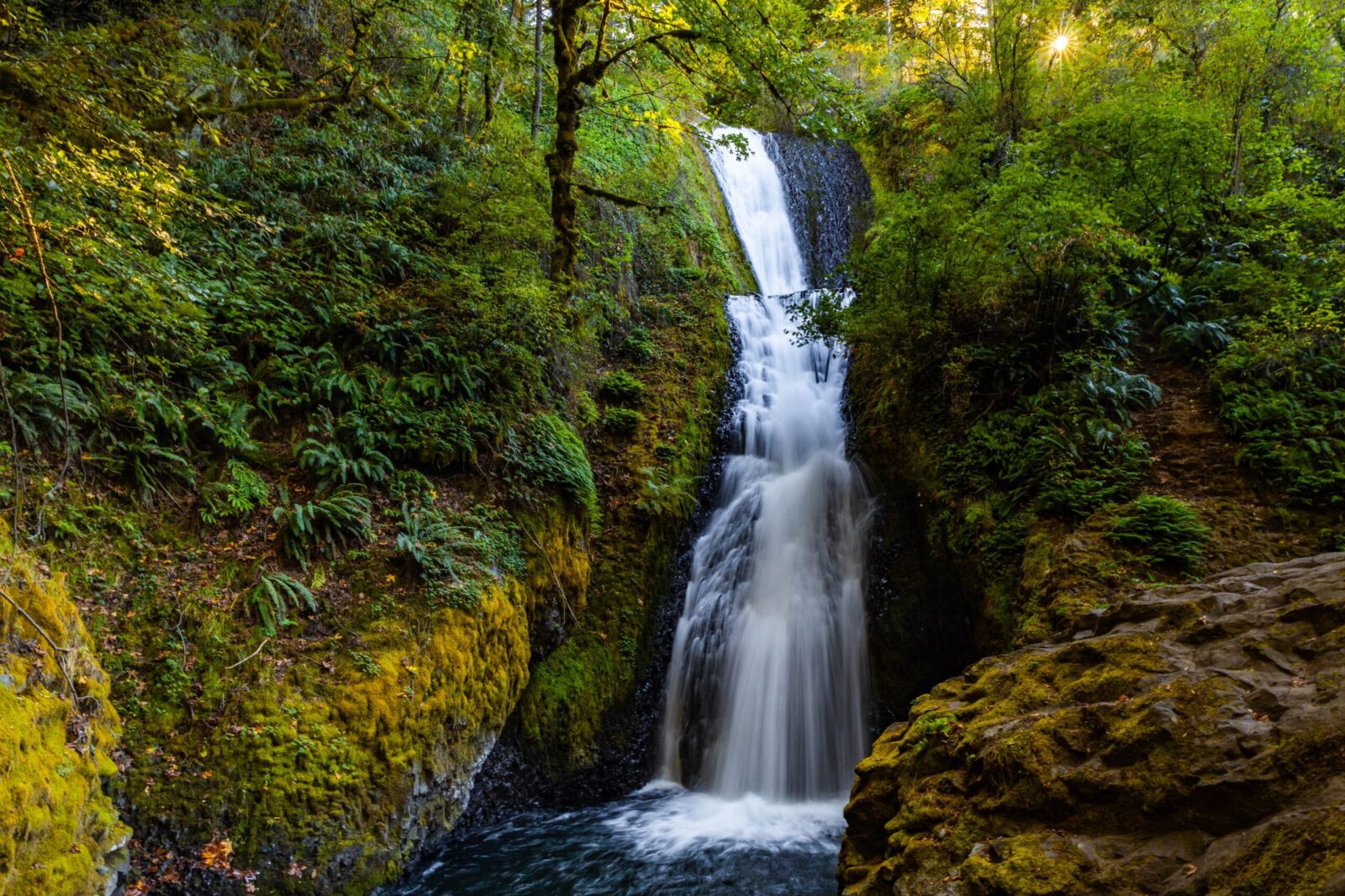
The Best Waterfall Pull-Offs Along the Highway
Past Crown Point, the Historic Columbia River Highway drops into the section locals call the Waterfall Corridor, where six named waterfalls sit within a few miles of one another and of the road itself. For the Gorge’s full waterfall lineup, check out our complete waterfalls guide.
The first major waterfall you’ll hit coming from Portland, Latourell Falls drops about 225 feet over a wall of columnar basalt you can see from the parking area without any walking at all. If you want a closer look, a short paved path leads to the base.
Bridal Veil Falls is a two-tiered waterfall that drops about 120 feet in total, reached by a half-mile round-trip trail that’s an easy walk for most fitness levels. It’s easy to miss from the road since it sits back in a side canyon, so watch for the signed pullout.
At roughly 240 feet, Wahkeena Falls is also the trailhead for a longer loop hike that connects up to Multnomah Falls through old-growth forest, but you don’t need to hike anywhere to appreciate the view from the base.
Horsetail Falls barely requires you to leave the car. At 176 feet, the falls are visible right from the road, with a small parking pullout and picnic spot at its base, making it one of the easiest stops on the entire route.
Oregon’s tallest year-round waterfall and its most visited natural attraction, Multnomah Falls deserves its own trip planning, given the timed permit requirement at its I-84 parking lot during summer months. If you’re driving the historic highway, you’ll reach it via the smaller lot directly on the route rather than the interstate exit. Because it draws such heavy crowds, plan for a short wait even outside of permit season. If you want to hike beyond the base viewpoint, our full Multnomah Falls hike guide covers the trail options in detail.
Biking the Historic Columbia River Highway State Trail
If two wheels sound more appealing than four, the highway corridor is one of the better bike routes in the Pacific Northwest. Roughly 20 of the historic route’s 73 miles have been converted into a paved, car-free state trail, split into a few disconnected segments rather than a single continuous path.
The most popular segment for casual riders runs through the Waterfall Corridor itself, where the two restored Multnomah Falls viaducts are now open to bicycles as well as cars under 35 feet. Farther east, a segment near Shellrock Mountain offers riders a roughly 6-mile car-free stretch past smaller waterfalls, including Starvation Creek and Lancaster Falls. The Mitchell Point Tunnel, reopened in 2025, connects riders via a restored basalt passage that had been closed since the interstate era. Near Hood River, a separate 4.5-mile universally accessible segment runs between Hood River and Mosier through the restored Mosier Twin Tunnels.
Bike rentals, including e-bikes, are available seasonally near several trailheads if you don’t want to bring your own. The trail segments are open to pedestrians, wheelchair users, and cyclists, and none charge for the ride itself, though a few trailheads have a small day-use parking fee.
Best Time of Year to Drive the Highway
Fall is our favorite season for this drive, and if you’re planning a trip specifically around foliage, we’ve got a full guide dedicated to timing your visit. In general, spring brings wildflowers and waterfalls running at their fullest from snowmelt, while summer brings the biggest crowds and the Multnomah Falls permit window. Winter thins out the visitor traffic considerably, though you’ll want to watch for temporary weather-related closures, especially around the Crown Point area, which sits more exposed to wind than most of the route.
Tips for Planning Your Drive
Give yourself at least three to four hours if you want to stop at the major waterfalls and Vista House rather than drive straight through. Starting early in the day, especially on weekends, makes a difference for parking at Multnomah Falls and Vista House specifically, both of which fill up fast.
Cell service is unreliable along the Historic Columbia River Highway, so download offline maps or take screenshots of directions before you go. Parking fees apply at several stops along the way, including Oregon state park day-use areas, so it’s worth having a state park pass or a few dollars in cash or card on hand. If you’re driving from Carson Ridge, plan on about an hour to reach Troutdale, making an early departure the easiest way to beat both traffic and crowds.
A few other things worth knowing before you head out: bring layers even in summer, since Crown Point and the corridor near Vista House are noticeably cooler and windier. Gas up before you leave, since services are limited past Corbett. And if a stop looks packed when you pull up, it’s often worth continuing to the next one and circling back later in the day. Traffic through the corridor tends to ease up by mid-afternoon on weekdays, even during the busier summer months.
Where to Stay: Make Carson Ridge Your Basecamp
One of the advantages of staying at Carson Ridge is how central it puts you for a drive like this. You’re close enough to make the highway a full-day trip without an early wake-up call, and close enough to come back to a hot tub and a quiet cabin afterward instead of a long drive home. When you take the Historic Highway during peak fall foliage, it’s one of the best weekends the Gorge has to offer. Reserve your stay now.
Frequently Asked Questions
Can you still drive the Historic Columbia River Highway?
Yes. The most popular section, from Troutdale through the Waterfall Corridor to Ainsworth State Park, is open to vehicle traffic. Some sections farther east mix drivable road with bike-and-pedestrian-only trail, so check current conditions if you’re planning to drive the full 73-mile historic route.
Is the Historic Columbia River Highway currently open?
The main Waterfall Corridor section is open, including both historic viaducts near Multnomah Falls that were closed for restoration in recent years. This corridor has a history of occasional weather- and construction-related closures, particularly near Vista House, so check Oregon’s TripCheck site for current, same-week conditions before you go.
How long does it take to drive the whole route?
The classic Troutdale-to-Ainsworth stretch takes about 45 minutes without stops, but plan for three to four hours if you want to actually get out at Vista House and the major waterfalls. Driving the entire 73-mile route to The Dalles, where sections allow it, is closer to a half-day trip.
Do you need a permit to drive the Historic Columbia River Highway?
No permit is required to drive the highway itself. The only permit involved is for parking at Multnomah Falls’ larger lot off I-84 during peak summer months, and it applies specifically to the interstate parking lot, not the historic highway route.
Is the Historic Columbia River Highway good for biking?
Yes. Roughly 20 miles of the original route have been converted into paved, car-free trail segments, including sections through the Waterfall Corridor and near Hood River, making it one of the more scenic bike routes in the region.